This project works towards the development of a web application that would allow users to automatically generate and customize a 3D map model of any given area. The end product is a customized map tile, that users co-design by making personal choices about the location, scope, and selection of environmental features.
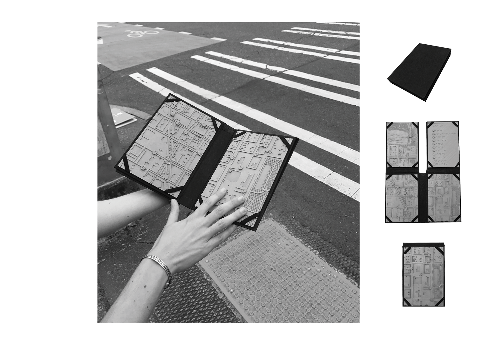
This project presents an alternative approach to understanding the pedestrian experience. Challenging the existing primacy afforded to vision, this work takes a tactile approach. Physical abstractions are used as a means to guide people through the multi-sensory environments encountered everyday. Designed as tools that enhance spatial understanding for people within a large range of visual capacities, these maps consider circumstances that influence a full spectrum of experience. The maps produced confront gaps in the cartographic record as it pertains to inclusive design, and considers how that is manifest in the lived experience.
Pairing a participatory, data-driven design approach together with interdisciplinary collaboration, these 3D printed, parametrically designed maps allow for user feedback, and ever changing open-data sets to be quickly incorporated.
Tactile MapTile is led by Anat Caspi, Taskar Center for Accessible Technology, and Jess Hamilton, UW Department of Landscape Architecture